
The Surface Water and Ocean Topography (SWOT) Earth observation satellite, a joint mission of the French space agency,CNES and NASA, and with contributions from the Canadian Space Agency (CSA) and the United Kingdom Space Agency (UKSA), is almost ready for transport in early October to the Vandenberg Space Force Base in California for a scheduled December 5 launch.
After spending a year being assembled, integrated and tested at the Thales Alenia Space’s facility in Cannes, France, the two-tonne SWOT satellite will soon be loaded on a U.S. Air Force C5-Galaxy freighter aircraft.
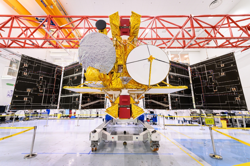
The launch on a SpaceX Falcon 9 from Vandenberg Space Force Base in California is scheduled for no earlier than December 5.
While Canada’s contribution is modest, a set of extended interaction klystrons (EIKs) for the radar instrument, the CSA characterizes the EIKs as “crucial.” The EIKS were produced by CPI Canada, of Georgetown, Ontario, who pioneered the EIK technology.
The benefit to Canada for participating in the mission is access to the data the satellite will generate. In particular, the CSA states that “Through this partnership, Canadian scientists will obtain early access to software tools required to understand SWOT data as it becomes available after satellite launch. SWOT data could lead to improvements in many water-related services in Canada, including weather predictions and flood warning systems.”
The SWOT Canadian science team is “led by Environment and Climate Change Canada (ECCC) and Fisheries and Oceans Canada (DFO), will be working towards mission objectives and desired outcomes within two main areas of research, hydrology and oceanography, to enhance our understanding of water cycle across the country.”
According to Thales Alenia Space, “SWOT features a number of unprecedented technological innovations and is based on a major disruptive technology, namely the wide-swath KaRIn interferometer designed by NASA’s Jet Propulsion Laboratory (JPL). CNES and Thales Alenia Space built the radio-frequency assembly for this instrument. KaRIn has two Ka-band synthetic aperture radar (SAR) antennas separated by a 10-metre boom that will enable it to view a 120-kilometre swath with a horizontal resolution on the order of 50 to 100 metres, configurable on either side of the satellite’s ground track.”
In a press briefing earlier this month Christophe Duplay, SWOT programme manager at Thales Alenia Space said, “SWOT is an emblematic mission not only because it seeks to address international climate stakes, but also because it will serve what is one of our most critical shared resources, Water. The satellite will allow us for the first time to survey the entire water cycle from lakes and rivers to seas and oceans. For the teams at Thales Alenia Space, this programme is the continuation of its longstanding partnership with CNES and NASA in the field of satellite altimetry since the successful Jason missions that have enabled operational oceanography to be deployed worldwide.”